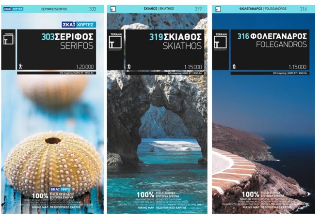
When you wander off the beaten path—and there is ample opportunity (and temptation) to do so when exploring a Greek island—you want to be sure that the path you’ve chosen goes where the map says it goes and doesn’t vanish into an undergrowth of thicket or morph into a dry creek bed. Luckily you can be sure of where you’re headed if your map is one of the highly accurate and exceptionally detailed topographic maps that Terrain Editions has produced for 48 Greek islands (as well as for the mountain regions of Mt. Parnitha and Mt. Pelion).

Terrain’s team of “traveling cartographers”, certified GIS analysts with a passion for both map-making and exploring the Greek countryside, conduct a complete field survey in preparing their maps. Outfitted with their handheld GNSS devices (Mobile Mapper) they cover every kilometer of road and path with their 4 x 4 or motorcycle—and on foot when the path can no longer be driven on. As company founder Stefanos Psimenos says “No matter where our customers may want to go, we have been there before them.” Terrain has circumnavigated every one of the islands it has produced maps for, as well as the islets off their coasts. This has resulted in an unprecedentedly detailed description of the coastline. The beaches, even the tiny stretches along coves accessible only by boat, are marked and characterized in terms of the sea bed and beach cover (sandy or pebbled) and the presence or absence of shade.
The maps are beautiful to look at and to hold. The non-cartographic elements—from the cover design to the key and descriptive text—have been designed by the award-winning design firm, mousegraphics. The maps are printed not on paper but instead on Polyart, a high-density clay-coated polyethylene film. They’re 100% waterproof and for all intents and purposes, rip-proof as well. It’s one of the few maps I’ve seen with both a list of credits—the members of the cartographic and design team who put together the map—and an expiration date, since Terrain collects revisions and updates their maps periodically. The (100% recyclable) Patmos map I got last year came with a date stamp (2009) and the instruction: “use until 2012”.
Elevations are of course indicated, and the segments of the primary and secondary hiking paths are marked with very useful detailed distance measurements between junctions (as short as 0.1 km if need be). The maps faithfully record such features as archaeological sites and chapels, caves and springs, but also more unusual points such as windmills, old stone lighthouses and threshing floors. These are maps to be used by enthusiasts of all kinds, from hikers and climbers to kayakers and divers. Canyoning routes are indicated, as are diving centers and the characteristics of the sea bed off the beaches. Oh, and beach bars are noted, too.
It is indicative of the reputation for accuracy and quality that the company has established in its brief five-year history that ViewRanger has partnered with Terrain Editions to make the latter’s topographic maps available as premium content for their mobile GPS app, as it has with organizations such as the Bundesamt für Geodäsie und Kartographie, National Geographic Maps, and the UK Ordnance Survey, highly rarefied cartographic company to be in, if you ask me.